


06 October 2017
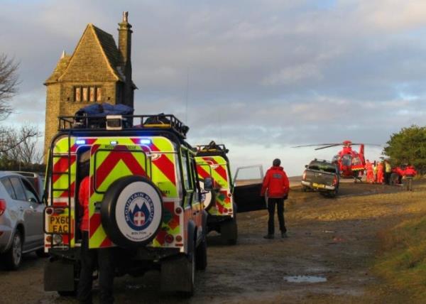
Bolton MRT’s 50 trained volunteers cover an area that spans 800 sq. km.
Bolton Mountain Rescue Team (Bolton MRT) will use cloud-based infrastructure in an effort to help improve the management and response times for its rescues.
The registered search and rescue charity was established in 1968, and has 50 volunteers on call round the clock throughout the year.
The teams cover an area so 800km2, from Rivington to the north and Manchester Airport in the south, and from Wigan in the west to Darwen and Bury in the east.
Bolton MRT previously ran its operations from shared desktops located at its base in Heaton and had no backup procedure in place. The ageing system restricted the team’s ability to access important data and IT resources remotely, and limited their ability to share information with other emergency agencies.
As a result, Bolton MRT chose SRD Technology UK to help manage and transform its IT infrastructure, and migrate it to the cloud.
SRD focuses on supporting cloud migrations for charities and not for profit organisations across the UK. It implemented Navisite’s Desktop-as-a-Service and Managed Microsoft Office 365 solution. This means Bolton MRT’s volunteers can now work remotely, with full access to an integrated and standardised suite of applications to help rescue operations.
The new cloud-based system will be a direct aid in helping Bolton MRT locate missing people and casualties. It will allow multiple emergency response agencies to work together and share information, in real-time, and in a single environment.
“Often in rescues, the biggest challenge is precisely locating the lost or injured person,” says Martin Banks, operational member and treasurer, Bolton MRT. “We’re now able to start the process of identifying the person’s location using an application which can be run on our system from any location.”
While the police can often triangulate a person’s mobile phone location, these data can be inexact, says Navisite. The SARLOC mountain safety positioning service, developed specifically for mountain rescue teams and now used across the country, is more accurate.
Bolton MRT uses Navisite’s cloud to access SARLOC data from any location. The positioning service requires a smartphone with GPS and mobile data service, and the consent of the lost person (all climbers are encouraged to register their mobiles prior to setting out).
The system works by sending a text message with a link to the mobile phone of the missing person. By clicking the link, any lost or injured person will be able to open a website that will calculate their location and notify Bolton MRT wherever they using a mapping application running on Navisite’s DaaS.
As a result, it’s claimed teams are able to locate lost or injured people much faster and with greater accuracy, no matter where the rescue team is located.